
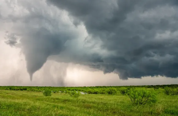
Storms turn the sky into a living lesson. The air moves, warms, cools, rises, and sinks, often within minutes. For people joining tornado chasing tours 2027, that motion becomes easier to study in real time. A chase is not only about seeing a funnel. It can reveal how heat, moisture, wind, pressure, and terrain shape severe weather. Careful observers learn to read clouds, radar clues, wind shifts, and storm growth. The experience can make complex atmospheric science feel clear, close, and useful, especially when each change happens right before your eyes.
Reading Heat, Moisture and Wind
Warm air gives storms fuel, while moisture helps clouds build high and fast. Wind adds another key piece. Speed and direction can change with height, creating wind shear that helps some storms organize. During a chase, these ideas stop being lines in a textbook. A clear sky may turn cloudy, then dark, then active. Small shifts matter. Chasers watch temperature, humidity, wind, pressure, and cloud bases together. This careful approach helps explain why one storm weakens while another grows stronger nearby. The atmosphere is always adjusting, even when the ground feels calm and still.
Following Storm Growth from The Ground
Storm growth can be quick, but it is rarely random. Rising warm air forms clouds, and stronger updrafts can build tall towers. For anyone joining storm chasing tours 2027, watching this change offers a useful view of storm structure. The cloud base, rain core, inflow area, and upper cloud shape each give clues. Radar adds another layer by showing movement and intensity. Ground observations then help connect those images to real conditions. Together, these tools show how a storm changes from a small cloud into a large weather system with distinct parts.
Understanding Rotation Before Tornado Formation
Rotation begins with wind patterns long before a tornado may appear. When winds turn or speed up with height, a storm can gain rotating motion. A strong updraft may then tilt that motion upright. This process is called vertical stretching, and it can tighten rotation as air rises. Not every rotating storm forms a tornado, which is an important point. During a safe chase, observers can study cloud motion, storm structure, and radar data without treating every dark cloud as a threat. That balance keeps the focus on learning, evidence, and sound weather judgment in changing conditions.
Using Radar To Track Storm Structure
Radar gives storm observers a view that the eye cannot provide. It can show rain bands, movement, intensity, and signs of organized rotation. When radar data is paired with what people see outside, storm structure becomes easier to understand. A trained guide can explain why one area looks stronger, where inflow may enter, and how the storm is moving. This makes a chase more than a roadside view of bad weather. It becomes a field lesson in timing, motion, and change. Radar also helps teams avoid risky positions as storms shift across open country.
Learning From Pressure And Cloud Changes
Pressure changes can offer another useful clue during severe weather. A falling pressure trend may signal a changing storm environment, while rising pressure can follow cooler outflow or storm passage. Cloud shape adds more detail. Low clouds, rising towers, rain curtains, and changing bases can reveal how air is moving. These signs become easier to notice after some practice. During a guided chase, simple readings can be linked to what appears overhead. That connection matters because atmospheric dynamics are not hidden ideas. They leave visible and measurable traces across the sky and ground every day.
Building Safer, Smarter Storm Knowledge
Good storm education includes safety at every stage. Severe weather can change fast, and distance, roads, visibility, and traffic all matter. A responsible chase keeps clear escape routes and follows weather alerts and local guidance. Learning also means knowing when not to approach. The best field lesson may come from staying well away while watching the storm evolve. Notes, photos, radar views, and weather readings can help people review each event later. That habit builds stronger understanding over time and turns exciting weather encounters into careful, useful study of atmospheric dynamics in practice.
Conclusion
Atmosphere dynamics become easier to understand when science meets real weather. A storm can show how heat, moisture, wind, pressure, clouds, and rotation work together in one moving system. Careful observation adds meaning to every radar image and weather reading. For curious travelers, storm chasing can also build respect for the power and limits of nature. Stormchasing.com can help readers explore this subject with a learning focus. The strongest experience is not simply seeing a tornado. It is leaving with clearer knowledge of why storms form, change, and sometimes become severe.
